
Wildlife crop damage / spatial documentation
Drone mapping and documentation of wildlife crop damage
See the whole damage area, not only a fragment.
We survey the crop from the air and prepare spatial documentation that helps establish the location, extent and area of visible damage. The orthomosaic is supported by measurements, source photography and a clear technical report.
- 01Field
- 02Capture
- 03Orthomosaic
- 04Damage outline
- 05Measurement
- 06Documentation
The full field context
Ground level shows a fragment.
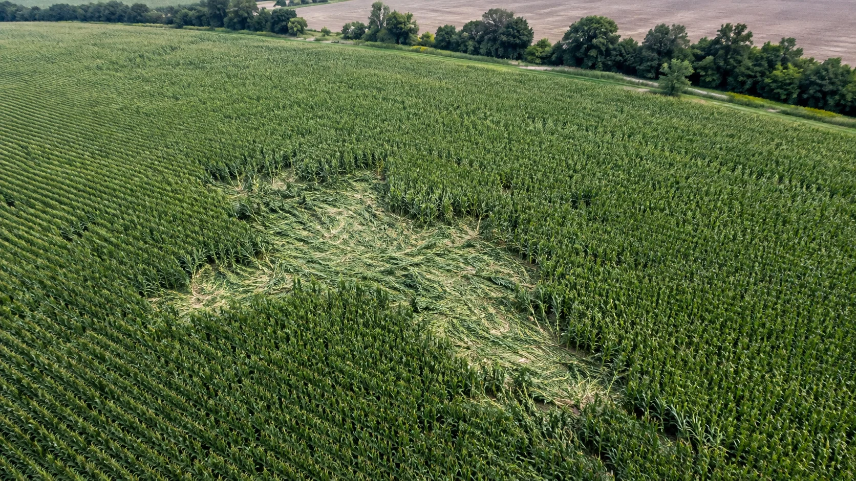
The air shows the scale.
Damage can occur in many parts of one field, including inside the crop canopy. Irregular shapes and dispersed areas make it difficult to assess the full extent using ground inspection alone.
An aerial survey records the whole parcel in one spatial frame and preserves its condition at a specific moment.
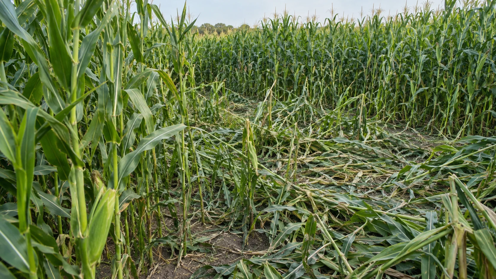
Image → measurement
From a field image
to measurable documentation.
Aerial images are processed into an orthomosaic. Visible damage can then be delineated to the agreed scope, measured and documented.
- 01Aerial image capture
- 02Field orthomosaic
- 03Visible damage boundary
- 04Area measurement
- 05Technical documentation
Working process
From the first report
to an organised damage record.
- 01Scope
Initial brief
We establish the location, crop, field area, character of damage and expected documentation scope.
- 02Capture
Aerial survey
We record the field through a planned mission at the level of detail required for the task.
- 03Reconstruct
Orthomosaic
Source images are processed into one coherent, georeferenced view of the area.
- 04Measure
Analysis and measurement
We delineate agreed areas of visible damage and calculate their surface area.
- 05Document
Documentation
We provide organised maps, measurements, source images and the agreed technical report.
What you receive
Material you can
return to.
Final deliverables depend on the agreed scope, survey conditions and source-data quality.
- 01
Orthomosaic
A georeferenced image of the entire analysed field.
- 02
Field boundary
The area and geometry covered by the work.
- 03
Damage areas
Spatial delineation of agreed, visible damage zones.
- 04
Area measurements
Surface area of individual zones and a result summary.
- 05
Photographic record
Selected source frames showing the character and distribution of damage.
- 06
PDF report
A clear summary of scope, maps, measurements and observations.
- 07
Spatial data
Agreed data formats for further use where the project requires them.
Technical report
The work does not end
with a drone photograph.
The report organises scope, method, maps, measurements and limitations for further assessment.
- 01Scope of work
- 02Location and input data
- 03Capture method
- 04Orthomosaic
- 05Identified damage areas
- 06Area summary
- 07Photographic record
- 08Notes and limitations
For parties working with documentation
One field.
Different documentation needs.
Farmer / agricultural holding
Documentation of the scale and location of observed crop damage.
Hunting club
Consistent spatial material supporting field inspection and documentation.
Expert / representative
Map-based source material that can supplement field observations.
Land manager
Repeatable documentation of agricultural parcel condition.
Method and limitations
Accuracy begins
with the right method.
A high-resolution orthomosaic does not automatically establish the cause of damage or the final economic value of loss. These concepts describe different stages and should not be treated as equivalent.
- 01Image resolution / GSD
- Image detail resulting from flight and camera parameters.
- 02Georeferencing accuracy
- The quality of positioning the work in a coordinate system.
- 03Visible damage boundary
- Outline accuracy depends on image legibility and the interpretation method.
- 04Severity interpretation
- Assessment of damage character requires context and often ground inspection.
- 05Yield loss / damage value
- A separate assessment that aerial imagery alone cannot decide.
Where needed, aerial documentation should be interpreted together with field inspection and information about the crop.
Selecting the tools
The task determines the equipment — not the reverse.
Mission design, aircraft, camera, positioning method and photogrammetric processing are selected according to field size, crop structure, terrain, required detail and expected output.
- 01Field size
- 02Crop structure
- 03Terrain
- 04Required detail
- 05Output format
- DJI Matrice platform
- RTK positioning
- Photogrammetric reconstruction
RTK is one part of the positioning workflow. RTK alone does not guarantee a particular accuracy without appropriate planning, control and processing.
NeoScout documentation is technical material supporting damage assessment and documentation. It does not replace actions or protocols required under the applicable statutory wildlife-damage assessment procedure.
Scope guide
What documentation might be useful?
Choose approximate parameters. This suggests a survey scope, not a price or official damage valuation.
Suggested scope
Selected crop: Maize
- Given the scale or scattered pattern: divide the site into survey sectors and map the full area.
- Add an outline of visible damage, area measurement and a labelled map.
Final scope depends on parcel boundaries, flight conditions, crop visibility and purpose. Causation and financial valuation need a separate procedure.
Discuss scope and locationFirst step
Let us look at the field first.
Based on the location, area and character of the damage, we will select the survey scope and data-processing method.