
Specialist services
Vineyard Intelligence — drone mapping and 3D vineyard models
A spatial record — from vine to parcel.
We combine mapping, 3D reconstruction, geometry and repeatable surveys into an organised vineyard record. Each result captures a specific parcel at a specific time; the scope is agreed before fieldwork.
- Parcel mapping
- 3D digital twins
- Geometry and measurement
- Repeat data campaigns
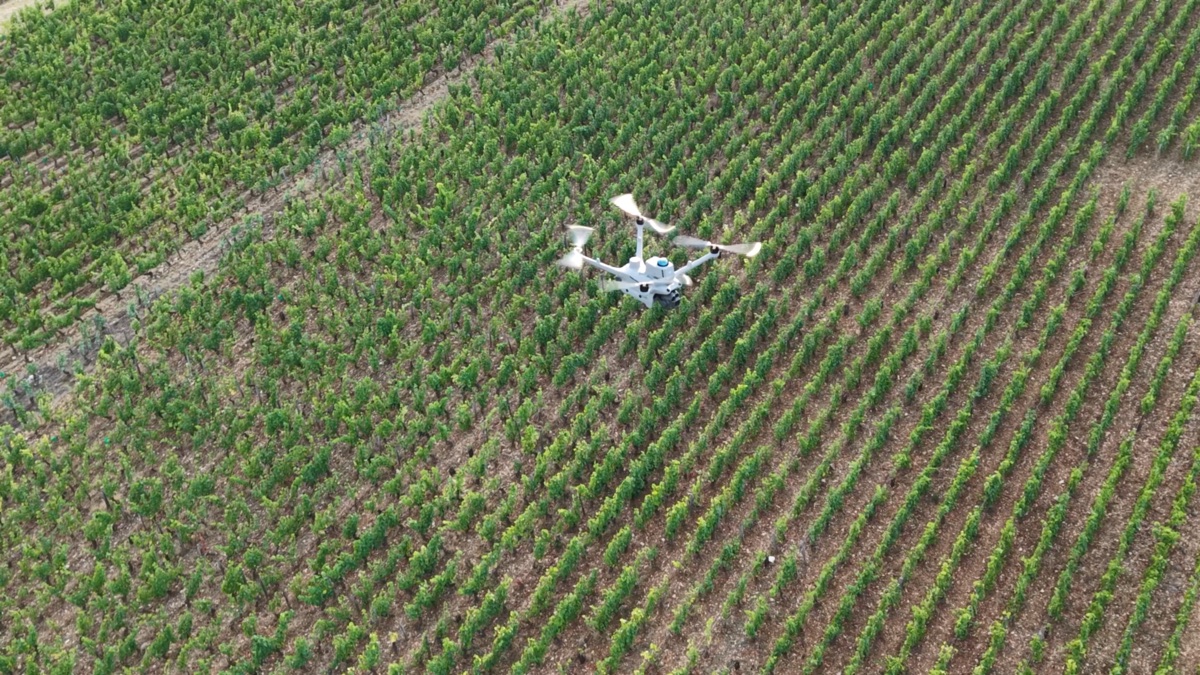
Method
Capture. Reconstruct. Measure. Document. Compare.
First we capture the parcel. Then we build its model, measure agreed elements and organise the information. Repeat campaigns can gradually form a comparable history.
- 01Capture
Capture the parcel
A planned flight records the whole parcel at one point in time.
- 02Reconstruct
Reconstruct it in 3D
Images become a legible model of the terrain and vineyard layout.
- 03Measure
Measure what matters
The model provides a shared basis for agreed measurements.
- 04Document
Document the parcel
Map, model and measurements form an organised dataset from one campaign.
- 05Compare
Compare over time
Later campaigns can be compared when the acquisition conditions and method are consistent.
NeoScout field work
Real data from the field.
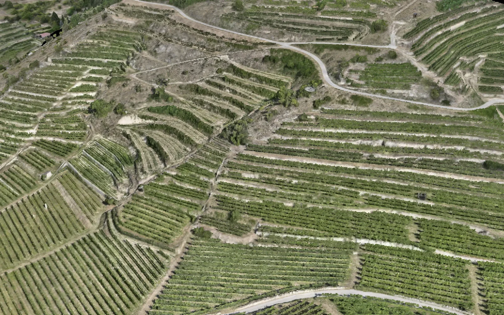
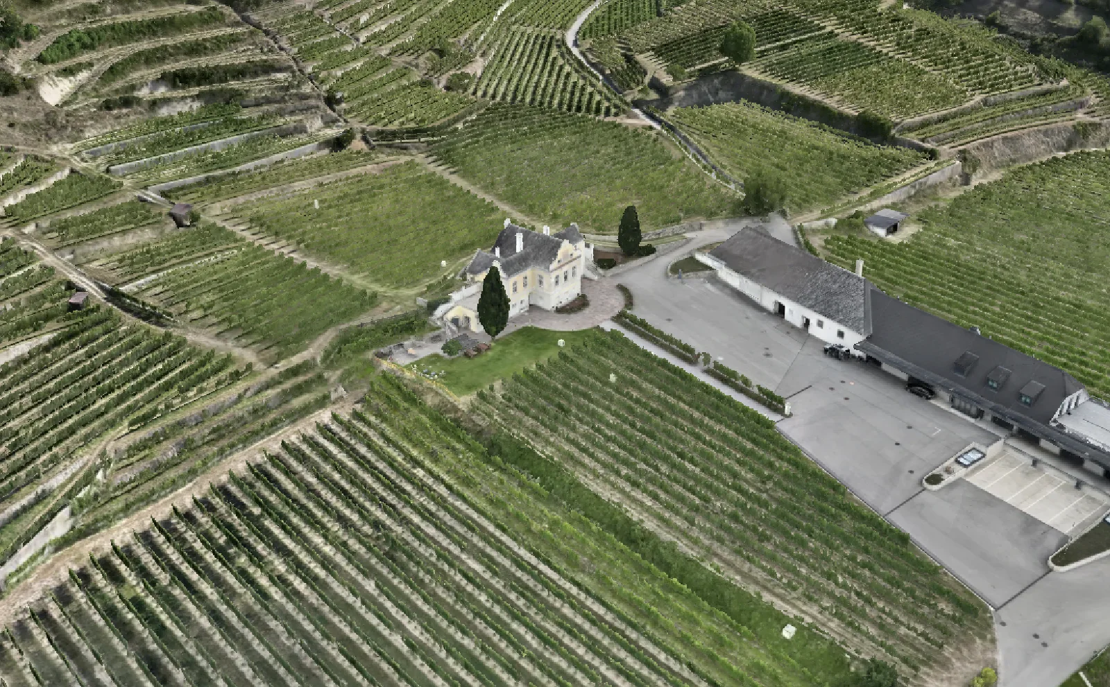
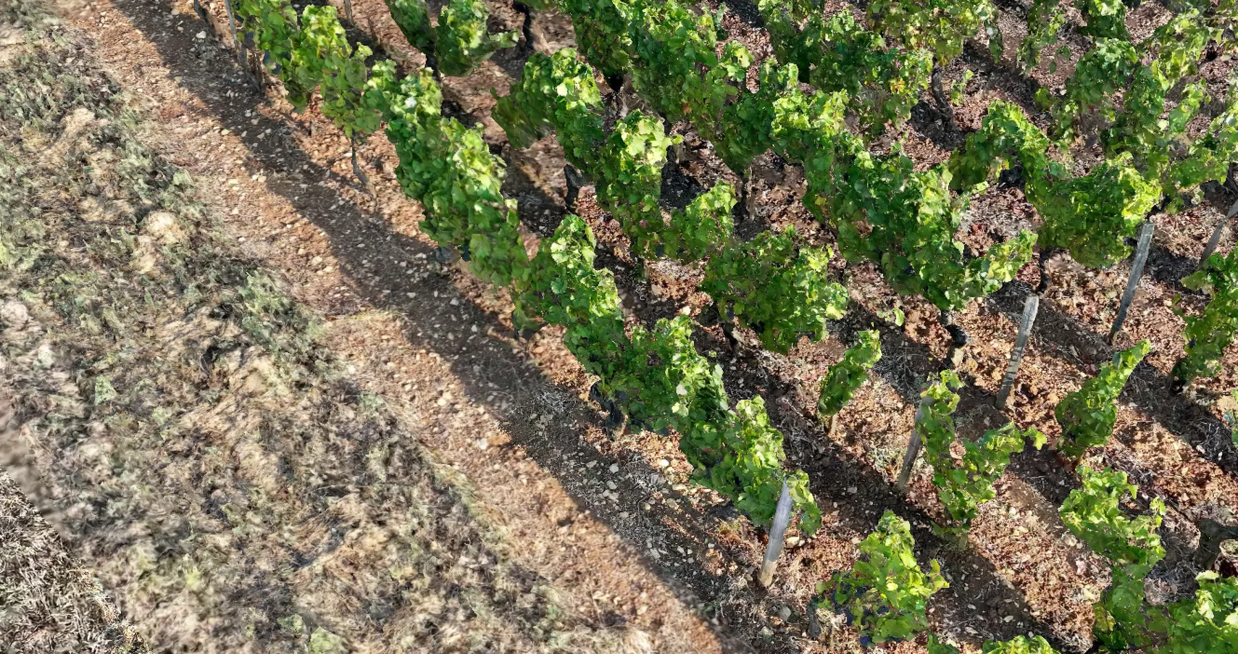
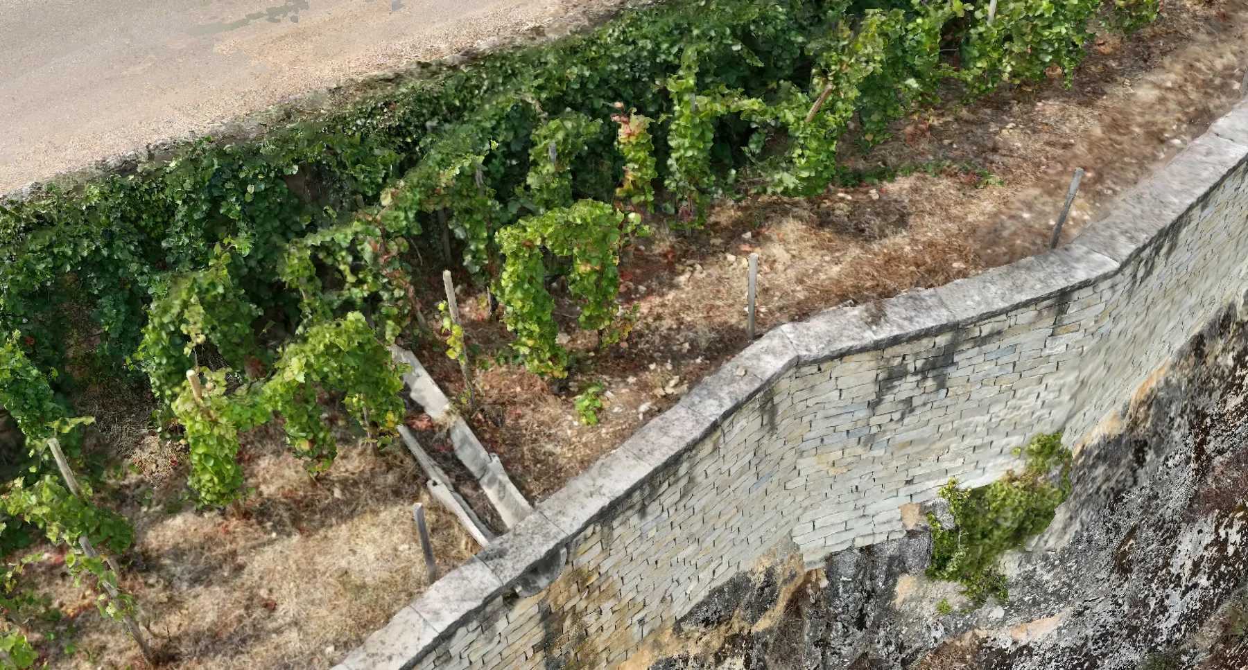
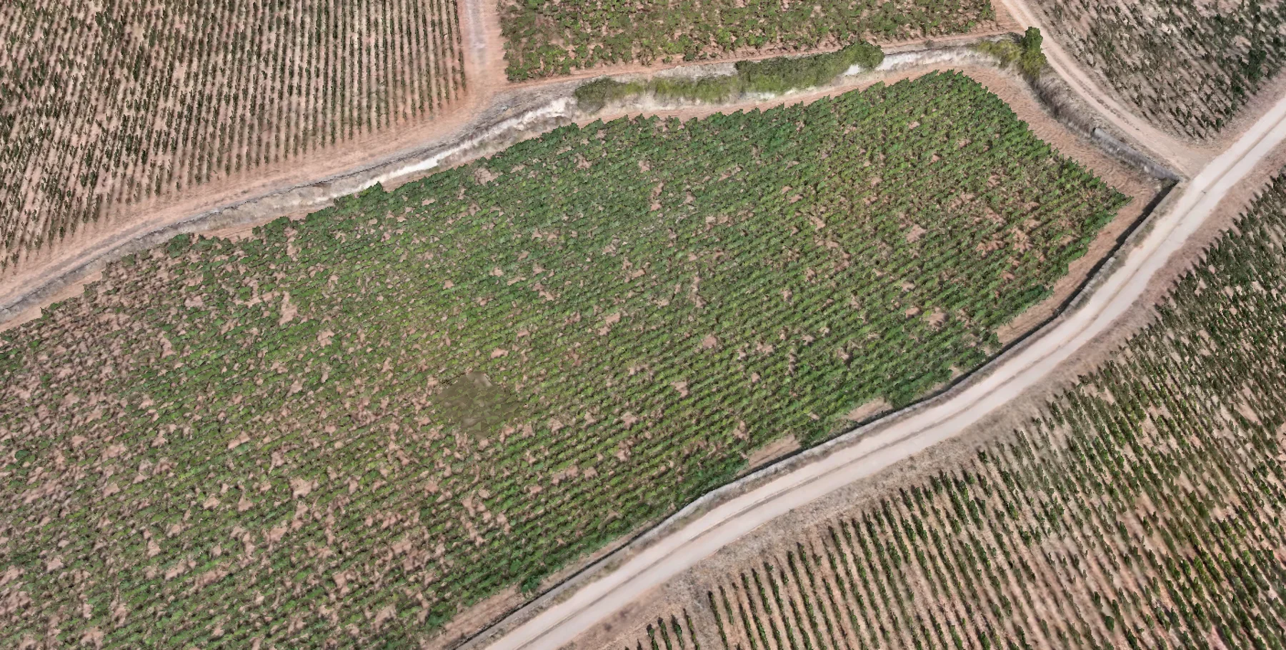
Two acquisition scales: the terraced vineyard landscape in Wachau and detailed documentation of rows and vines in Burgundy.
Wachau / Austria
Steep vineyards. Full terrain context.
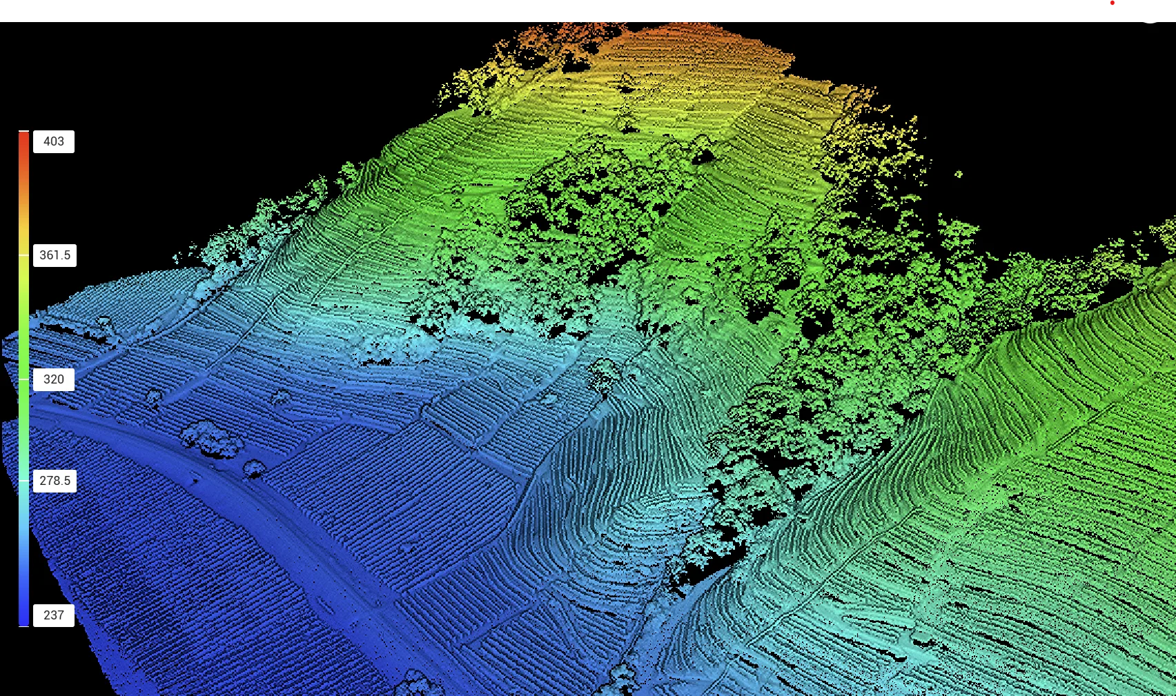
On steep vineyard sites, a conventional top-down image does not describe the full geometry. Terrain reconstruction preserves slope, terraces, access routes, vineyard rows and their elevation relationships.
Burgundy / France
From parcel scale to individual vine detail.
In Burgundy we also worked at low acquisition heights, recording vineyard rows and individual vine structure at high spatial detail. The resulting dataset can support 3D reconstruction, measurements, infrastructure documentation and future repeat surveys.
3D models
NeoScout photogrammetric reconstructions.
Four real NeoScout photogrammetric reconstructions from Burgundy, presented without parcel names.
Burgundy, France
Model 01
A parcel model built from image data as a technical record of vineyard terrain and structure.
A technical record of parcel geometry and surrounding terrain.
Burgundy, France
Model 02
A parcel model built from image data as a technical record of vineyard terrain and structure.
A technical record of parcel geometry and surrounding terrain.
Burgundy, France
Model 03
A parcel model built from image data as a technical record of vineyard terrain and structure.
A technical record of parcel geometry and surrounding terrain.
Burgundy, France
Model 04
A parcel model built from image data as a technical record of vineyard terrain and structure.
A technical record of parcel geometry and surrounding terrain.
Data layers
From core geometry to an operational record.
The availability of each layer depends on scope, source-data quality and the agreed processing method.
- 01Baseline output
3D model
A spatial reconstruction of the parcel and its context.
- 02Baseline output
Orthomosaic
A calibrated top-down view for review and documentation.
- 03Baseline output
Terrain and elevation
Landform and elevation relationships derived from the model.
- 04Project scope
Vine rows
Vectorised row structure within the agreed project scope.
- 05Project scope
Individual vines
An object record where resolution and conditions allow.
- 06Project scope
Missing-vine observations
An observation layer for field review, not an automated diagnosis.
- 07Project scope
Trellis, posts and walls
Selected structural elements recorded to the project brief.
- 08Project scope
Infrastructure
Roads, boundaries and assets relevant to parcel management.
- 09Baseline output
Measurements
Agreed lengths, areas and spatial relationships.
- 10Baseline output
Survey history
Repeatable capture with dated datasets kept as distinct records.
- 11Project scope
Season-to-season comparison
Change analysis requires comparable conditions and a separately agreed method.
A record through time
Each survey adds a chapter — it does not replace the last.
A repeatable data structure enables comparison between seasonal campaigns. Specific conclusions require an agreed method and comparable capture conditions.
- Survey 01
Full canopy and fruit
The parcel recorded during a developed stage of the season.
- Survey 02
Post-harvest or post-pruning
A second record of geometry and visible parcel elements.
- Survey 03
Next season
A new campaign preserved alongside earlier datasets.
Comparison between campaigns requires a consistent method, capture conditions and analysis scope.
Practical value
Shared context for field decisions.
Condition documentation
A legible spatial record of the parcel at a specific moment.
Measurement and planning
One geometric basis for discussing the scope of work.
Collaboration
Visual context that is easier to share with teams and partners.
Data continuity
Successive campaigns organised as a history, not loose files.
Start with the parcel
Let’s build a useful spatial record of your vineyard.
We will define the objective, required level of detail, capture conditions and the right format for the outputs.